Trail Walking La Palud-sur-Verdon - Sentier Blanc-Martel - Photo
 i20
i20

User

© OpenStreetMap contributors
Length
Length
15.4 km
Max alt
Max alt
903 m
Uphill gradient
Uphill gradient
1171 m
Km-Effort
Km-Effort  
31 km
Min alt
Min alt
556 m
Downhill gradient
Downhill gradient
1268 m
Boucle
Boucle
No
Creation date :
2014-12-10 00:00:00.0
Updated on :
2014-12-10 00:00:00.0

(2 Reviews)

Walking
Walking
--
Difficulty : Medium

Scan this QR Code to open this trail in the SityTrail application

FREE GPS app for hiking

Logo SityTrail SityTrail

IGN / Geographical institutes

Download SityTrail from the App Store Download SityTrail from Google Play

Logo SityTrail SityTrail World

The world is yours!

Download SityTrail from the App Store Download SityTrail from Google Play Download SityTrail on Huawei AppGallery

About

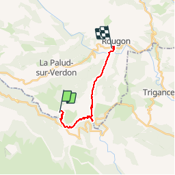
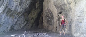
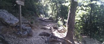
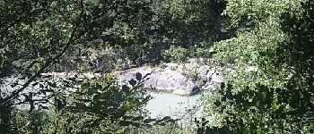
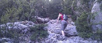
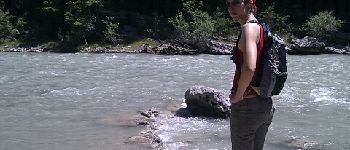
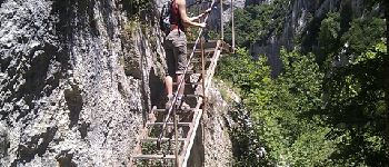
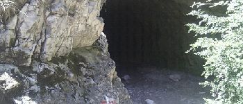
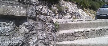
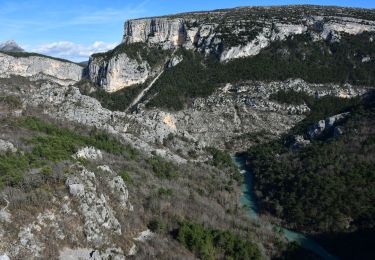
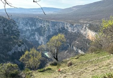
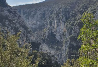
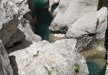
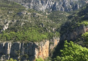
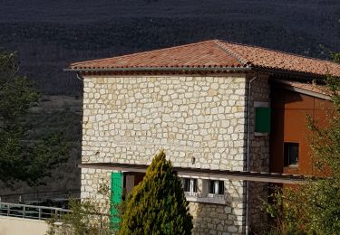
Trail Walking of 15.4 km to be discovered at Provence-Alpes-Côte d'Azur, Alpes-de-Haute-Provence, La Palud-sur-Verdon. This trail is proposed by i20.

Description

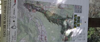
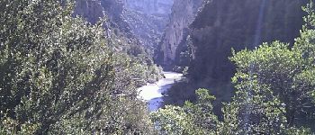
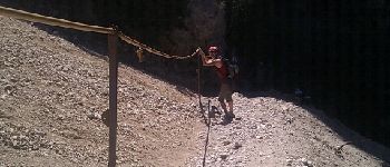
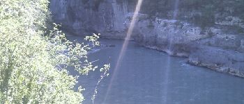
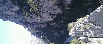
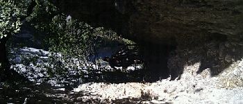
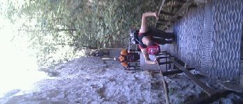
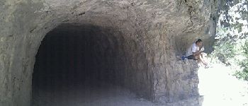
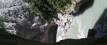
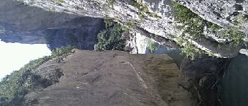
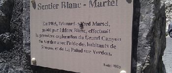
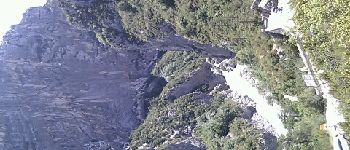
La classique des gorges du Verdon.
Quelques erreurs de positions GPS dûes à la situation très encaissée (Au niveau de la Mescla, la corniche est 735m plus haut)

Elevation profile

Photos

Points of interest

Point of interest La Palud-sur-Verdon - entrée gorges - Photo
i20
LA PALUD-SUR-VERDON 
Point of interest La Palud-sur-Verdon - pré d'issane - Photo
i20
LA PALUD-SUR-VERDON 
Point of interest La Palud-sur-Verdon - jolie vue - Photo
i20
LA PALUD-SUR-VERDON 
Point of interest La Palud-sur-Verdon - escaliers - Photo
i20
LA PALUD-SUR-VERDON 
Point of interest La Palud-sur-Verdon - câble sans difficulté - Photo
i20
LA PALUD-SUR-VERDON 
Point of interest Aiguines - grotte - Photo
i20
AIGUINES 
Point of interest La Palud-sur-Verdon - carrefour pour la mescla - Photo
i20
LA PALUD-SUR-VERDON 
Point of interest La Palud-sur-Verdon - la mescla - Photo
i20
LA PALUD-SUR-VERDON 
Point of interest La Palud-sur-Verdon - la mescla - Photo
i20
LA PALUD-SUR-VERDON 
Point of interest La Palud-sur-Verdon - pause à la mescla - Photo
i20
LA PALUD-SUR-VERDON 
Point of interest La Palud-sur-Verdon - la mrscla - Photo
i20
LA PALUD-SUR-VERDON 
Point of interest La Palud-sur-Verdon - bas roche imbert - Photo
i20
LA PALUD-SUR-VERDON 
Point of interest La Palud-sur-Verdon - haut roche imbert - Photo
i20
LA PALUD-SUR-VERDON 
Point of interest La Palud-sur-Verdon - escaliers roche imbert - Photo
i20
LA PALUD-SUR-VERDON 
Point of interest La Palud-sur-Verdon - descentearriete - Photo
i20
LA PALUD-SUR-VERDON 
Point of interest La Palud-sur-Verdon - pause repas - Photo
i20
LA PALUD-SUR-VERDON 
Point of interest La Palud-sur-Verdon - baume aux chiens - Photo
i20
LA PALUD-SUR-VERDON 
Point of interest La Palud-sur-Verdon - avant tunnels - Photo
i20
LA PALUD-SUR-VERDON 
Point of interest La Palud-sur-Verdon - tunnel contourné - Photo
i20
LA PALUD-SUR-VERDON 
Point of interest La Palud-sur-Verdon - tunnel n 1 - Photo
i20
LA PALUD-SUR-VERDON 
Point of interest La Palud-sur-Verdon - tunnel n 2 - Photo
i20
LA PALUD-SUR-VERDON 
Point of interest La Palud-sur-Verdon - dans tunnel - Photo
i20
LA PALUD-SUR-VERDON 
Point of interest La Palud-sur-Verdon - baume aux pigeons - Photo
i20
LA PALUD-SUR-VERDON 
Point of interest La Palud-sur-Verdon - depuis sortie tunnel - Photo
i20
LA PALUD-SUR-VERDON 
Point of interest Rougon - parking canoé - Photo
i20
Point of interest Rougon - explucations - Photo
i20
ROUGON 
Point of interest Rougon - arrivée - Photo
i20
ROUGON 

Positioning

Country:
France
Region :
Provence-Alpes-Côte d'Azur
Department/Province :
Alpes-de-Haute-Provence
Municipality :
La Palud-sur-Verdon
Location:
Unknown
Start:(UTM)
286292 ; 4847201 (32T) N.

Comments

Please log in to post a review or rate the element


Je pense que vous souhaitiez commenter l'application, pas mon tracé :-)


Bon logiciel avec beaucoup de fonctionnalités. Un gros défaut à corriger rapidement le calcul du dénivelé qui est complètement aberrant.


Trails nearby

Trail Walking Aiguines - Belvédère, gorges, Inbut, sentier Vidal - Photo
Walking
MarcLEBARON

Walking

Difficult
(3)
Aiguines, Provence-Alpes-Côte d'Azur, Var, France
9.3 km | 20 km-effort
3h 35min
Yes
Trail Walking La Palud-sur-Verdon - Verdon : Sentier Blanc Martel - Photo
Walking
manumax

Walking

Medium
(1)
La Palud-sur-Verdon, Provence-Alpes-Côte d'Azur, Alpes-de-Haute-Provence, France
16.1 km | 39 km-effort
6h 43min
No
Trail Walking La Palud-sur-Verdon - bastidon - Photo
Walking
xav34830

Walking

Medium
(1)
La Palud-sur-Verdon, Provence-Alpes-Côte d'Azur, Alpes-de-Haute-Provence, France
18.4 km | 33 km-effort
Unknown
Yes
Trail Walking La Palud-sur-Verdon - Chalet de la Maline - Point Sublime - Photo
Walking
LtZIP

Walking

Very difficult
La Palud-sur-Verdon, Provence-Alpes-Côte d'Azur, Alpes-de-Haute-Provence, France
14.4 km | 28 km-effort
6h 19min
No
Trail Walking La Palud-sur-Verdon - Sentier Blanc Martel - Photo
Walking
ETMU5496

Walking

Difficult
La Palud-sur-Verdon, Provence-Alpes-Côte d'Azur, Alpes-de-Haute-Provence, France
15.6 km | 31 km-effort
6h 57min
No
Trail Walking La Palud-sur-Verdon - 2023-03-24 Bastidon - Ravin du Brusc - Photo
Walking
GUIDE
Kargil

Walking

Difficult
La Palud-sur-Verdon, Provence-Alpes-Côte d'Azur, Alpes-de-Haute-Provence, France
13.3 km | 25 km-effort
5h 19min
No
Trail Walking Aiguines - Sentier de l'imbut - Photo
Walking
Indi34

Walking

Medium
Aiguines, Provence-Alpes-Côte d'Azur, Var, France
10.4 km | 27 km-effort
4h 0min
Yes
Trail Walking Aiguines - Gorges du Verdon - Sentier de l'Imbut - Photo
Walking
PiloudeBamako

Walking

Very difficult
Aiguines, Provence-Alpes-Côte d'Azur, Var, France
11.3 km | 33 km-effort
3h 35min
No
Trail Walking La Palud-sur-Verdon - Verdon, le sentier Martel - Photo
Walking
liocol

Walking

Difficult
La Palud-sur-Verdon, Provence-Alpes-Côte d'Azur, Alpes-de-Haute-Provence, France
13.2 km | 26 km-effort
5h 24min
No


Close
My subscriptions